
📝 Description
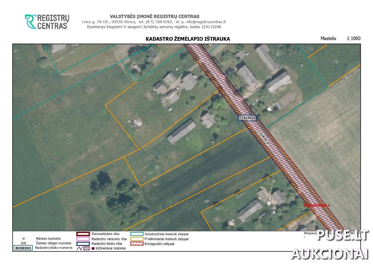
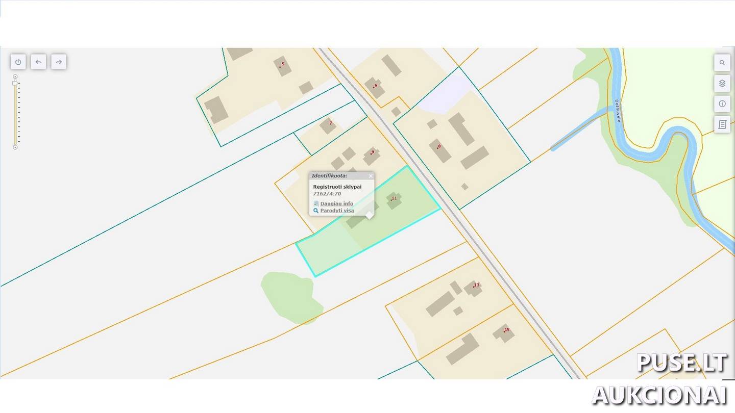
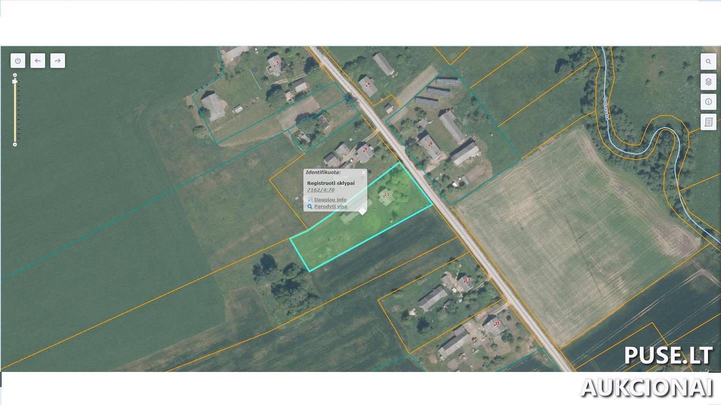
This land plot covers an area of 0.2802 ha and is located in Radviliškis District Municipality, Skomaičiai village, Lankos street number 11. The property belongs to the second category and is being sold through bailiff auctions with a starting price of 4688 EUR. Its main usage purpose is residential area, suitable for construction of low-rise residential buildings. The total plot area includes 0.2802 ha, of which 0.1400 ha is arable land and 0.1402 ha is built-up territory. The land farm yield score reaches 52.0.
Several special land use conditions (SŽNS) apply to the plot but are not registered in the Real Estate Register: these include protection strips and zones for surface water bodies, road protection zones, and electricity network protection zones. The property is under arrest with restrictions on disposal rights.
The auction with a starting price of 4688 EUR starts on 2024-05-07 12:39:19 and ends on 2024-06-06 12:39:59. The property's unique number is 4400-0114-7811, while the cadastral number is 7162/0004:70. For detailed information or viewing, please contact the bailiff office.
📍 Location
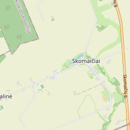
📍 Radviliškio r. sav. Skomaičių k. Lankos g. 11
❓ Frequently asked questions
What is the starting price of the land plot in Radviliškis district?
The starting price for the land plot at Lankos street 11, Skomaičiai village is 4688 EUR.
When do bailiff auctions end for this 0.2802 ha plot?
The auction starts on 2024-05-07 12:39:19 and ends on 2024-06-06 12:39:59.
What is the purpose and area of the land plot being sold?
The main usage purpose is Residential Area, and the nature is Low-rise residential buildings construction. The total area is 0.2802 ha.
What are the key cadastral and unique data for this property?
Cadastral number: 7162/0004:70, Unique number: 4400-0114-7811.
Are there special restrictions (SŽNS) applied to this plot?
Yes, protection strips and zones for surface water bodies, road protection zones, and electricity network protection zones apply.
What is the land farm yield score?
The land farm yield score is 52.0.