
📝 Description
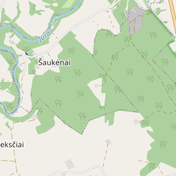
For sale is a 1/5 share of an agricultural land plot located in Šaukėnai Village, Tauragė District Municipality, within the Pagramančio Regional Park. This long-term investment object has a starting price of 1504 EUR and is currently being sold at bailiff auctions ending on November 15, 2026, at 09:07:59.
The total area of the plot is 2.68 hectares, with the share for sale comprising 0.536 hectares. The current usage order of the plot is not specified. The agricultural land productivity score is 24.0, indicating its primary purpose for farming.
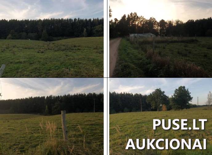
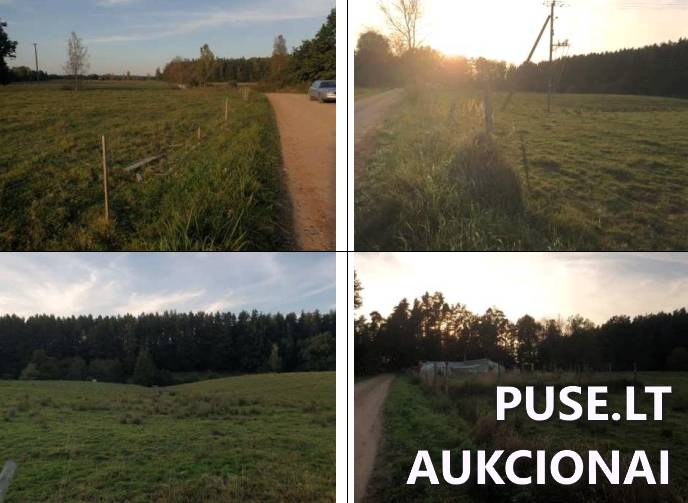
The plot has an irregular polygonal shape with a relatively flat relief. The terrain features varied cover: grassland covers most of the area, while some parts are covered with trees and shrubs, including a forest occupying 0.0512 hectares. Additionally, a water body occupies 0.16 hectares of the plot. Access to the plot is provided via an unpaved road bordering its southern section.
The property is strategically located in Tauragė District, approximately 3.5 km west of Highway 164 (Mažeikiai - Plungė - Tauragė).
Please note that the cadastral numbers are 7735/0006:122 and the unique identifier is 7735-0006-0122. Since this is agricultural land, buyers must comply with the requirements of the Law on Acquisition of Agricultural Land and obtain consent from the National Land Service to purchase the property, which must be submitted to the bailiff. The property is currently under a lien.
The total area of the plot is 2.68 hectares, with the share for sale comprising 0.536 hectares. The current usage order of the plot is not specified. The agricultural land productivity score is 24.0, indicating its primary purpose for farming.
The plot has an irregular polygonal shape with a relatively flat relief. The terrain features varied cover: grassland covers most of the area, while some parts are covered with trees and shrubs, including a forest occupying 0.0512 hectares. Additionally, a water body occupies 0.16 hectares of the plot. Access to the plot is provided via an unpaved road bordering its southern section.
The property is strategically located in Tauragė District, approximately 3.5 km west of Highway 164 (Mažeikiai - Plungė - Tauragė).
Please note that the cadastral numbers are 7735/0006:122 and the unique identifier is 7735-0006-0122. Since this is agricultural land, buyers must comply with the requirements of the Law on Acquisition of Agricultural Land and obtain consent from the National Land Service to purchase the property, which must be submitted to the bailiff. The property is currently under a lien.
❓ Frequently asked questions
What is the starting price and area of the agricultural land share being sold?
The share for sale is 1/5 of the plot, comprising 0.536 hectares. The starting price is 1504 EUR.
When does the bailiff auction for this land plot take place?
The auction started on October 16, 2024 and ends on November 15, 2026 at 09:07:59.
What is the primary purpose of this plot and what is its productivity score?
The plot's purpose is agricultural land, and the agricultural land productivity score is 24.0.
What special conditions apply to acquiring this agricultural land plot?
Buyers must comply with the requirements of the Law on Acquisition of Agricultural Land and submit consent from the National Land Service regarding the plot acquisition to the bailiff.
What are the main physical characteristics of the object?
The plot has an irregular polygonal shape with relatively flat relief. It includes 0.0512 hectares of forest and a water body of 0.16 hectares.
Which organization is conducting the auction?
The auction is conducted by bailiff Kęstutis Košys, representing K.Košio Bailiff Office.
Are there restrictions on disposing of this property?
Yes, the property is currently under a lien.